Product
Recommended article
- The Hazards of Airborne Particulate Matter (PM) and the Role of PM2.5 Air Quality Monitor
- Selection of Meteorological Monitoring Equipment for Highways and Its Functions
- Dust Monitoring and Control System in Open - pit Coal Mine
- Vehicle - Mount Weather Stations: Applications and Advantages
- The Intimate Link between Negative Oxygen Ion Monitors and Forest Tourism Resources
- Portable Weather Station: Your Pocket-Sized Environmental Companion
Contact us
Shandong Fengtu IOT Technology Co., Ltd
Sales Manager:Ms. Emily Wang
Cel,Whatsapp,Wechat:+86 15898932201
Email:info@fengtutec.com
Add:No. 155 Optoelectronic Industry Accelerator, Gaoxin District, Weifang, Shandong, China
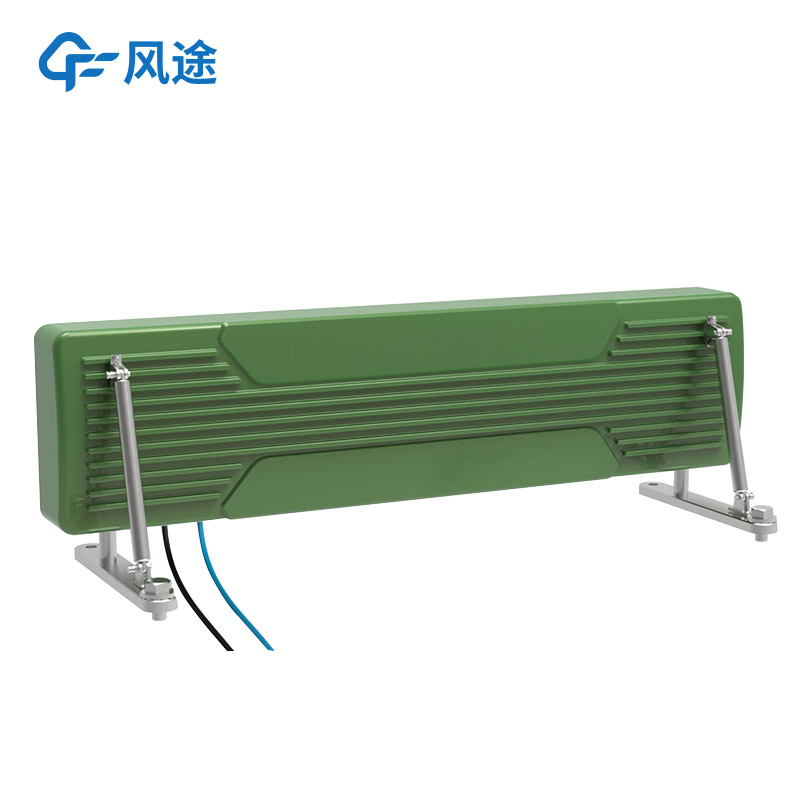
Slope Stability Radar
Model:FT-BPLD1
Brand:fengtu
Related products
1.Introduction to Slope Stability Radar system
Slope Stability Radar is used to measure the displacement, settlement, tilt of rock mass and soil mass, or the deformation of buildings, structures and foundations within a certain range.Slope Stability Radar is a high-precision, portable microwave interferometry micro-deformation monitoring product based on a broadband MIMO array.It uses a non-contact method to conduct high-precision uninterrupted cyclic measurements of the target body, and accurately measures the displacement changes and displacement of the monitored target.Speed, it can accurately track slow and tiny displacements, thereby achieving all-day, all-weather, non-contact, high-precision, space-time continuous remote monitoring of the monitored target.It is a new high-precision measuring instrument in the industry.
By remotely scanning the surface of the monitoring area, high-precision displacements within the entire area are obtained to achieve continuous monitoring of the entire area.And through comparative analysis of the scan results and the early warning threshold, automatic early warning is achieved to achieve the purpose of early discovery, early warning, ensuring safety, and reducing losses.This product has the characteristics of all-weather, all-weather, large-scale, and high-precision functions, and is suitable for slope deformation monitoring in open-pit mines, water conservancy and hydropower dams, geological landslide disasters, and other scenarios.
2.Slope Stability Radar product usage
Building deformation monitoring
Slope deformation monitoring
Mine deformation monitoring
Foundation pit deformation monitoring
Dam deformation monitoring
3.Product features of Slope Stability Radar
Rapid deployment: instrument deployment takes less than 1 minute
Convenient and fast: single-person installation operation
Measurement accuracy: 0.1mm
Adaptable; 24/7
Cost of use: recycling
Safety risk: No need to approach the measured area
4.Slope Stability Radar complies with specifications
"CH/T 3020-2018 Technical Regulations for Lidar Measurement of Real-life Three-Dimensional Geographic Information Data"
"GJB 6692-2009 General Specifications for Airborne Synthetic Aperture Radar"
5.Slope Stability Radar performance parameters
| Structural form | MIMO, slide rail type, rotating type |
| Erection method | Supports fixed, vehicle-mounted and other installation methods |
| Working frequency band | 5.2-6GHz or 24-26GHz |
| Monitoring information | Displacement/velocity/acceleration |
| Measure distance | ≥5km |
| Measurement accuracy | Deformation accuracy ≤0.1mm |
| resolution | Resolution ≥1㎡ at 1km |
| Monitoring range | Horizontal 100° Vertical 40° |
| Monitoring area | Depends on monitoring distance |
| size | Length x width x height 140cm x 15cm x35cm |
| weight | Less than 10kG |
| Power supply requirements | Supports mains, generator, solar and other power supply modes |
| Monitoring cycle | ≤1s |
| Power consumption | 30W |
| working temperature | -40℃~60℃ |
| Protection level | IP67 |
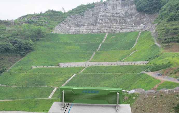
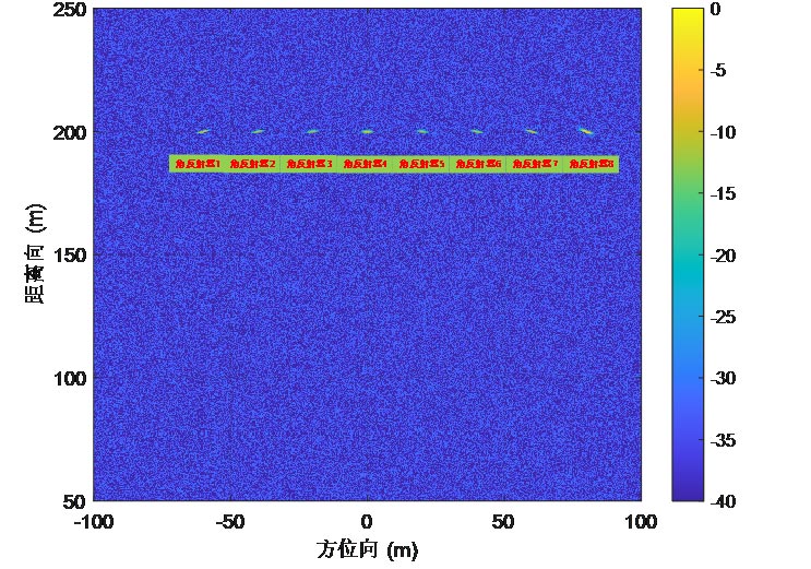
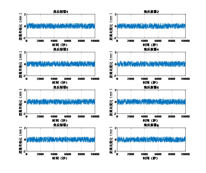
6.Slope Stability Radar application display
Related article
-
Meteorological Observation Station: Unraveling the Mysteries of Weather
2024-09-20 -
Atmospheric Environment Monitoring System: The Key to Precise Pollution Control”
2024-10-11 -
Ecological display, less scenic environment monitoring system
2024-05-24 -
Grid-based environmental monitoring system, a refined environmental management model
2024-04-28 -
Inventory of common types of weather monitoring equipment
2024-05-21 -
Features Galore: Key Advantages of Environmental Monitoring Station FT - FZ3
2024-10-12 -
Functions of automatic meteorological monitoring station for field microclimate
2024-07-25 -
Prairie Weather Stations Promote Data Sharing
2024-05-08


 Get a Free Quote